


FOB Price
Get Latest Price1523 ~ 1763 / Set ( Negotiable )
|1 Set Minimum Order
Country:
China
Model No:
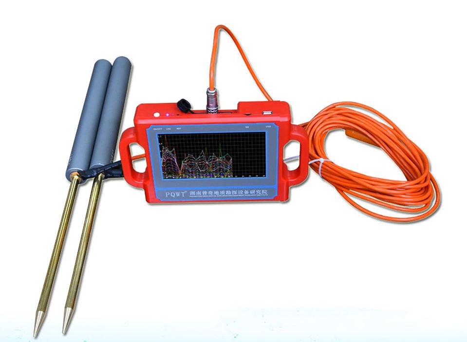
PQWT-S150
FOB Price:
1523 ~ 1763 / Set ( Negotiable ) Get Latest Price
Place of Origin:
Hunan, China
Price for Minimum Order:
1523 per Set
Minimum Order Quantity:
1 Set
Packaging Detail:
Packed in Alumium Specialized flight Box + Carton
Delivery Time:
Express shipping, delivery time around 5~7 working
Supplying Ability:
300 Set per Month
Payment Type:
Other, PayPal, Western Union, T/T
Product Group :
Contact Person Nicole
Changsha, Hunan
| Country: | China |
| Model No: | PQWT-S150 |
| FOB Price: | 1523 ~ 1763 / Set ( Negotiable ) Get Latest Price |
| Place of Origin: | Hunan, China |
| Price for Minimum Order: | 1523 per Set |
| Minimum Order Quantity: | 1 Set |
| Packaging Detail: | Packed in Alumium Specialized flight Box + Carton |
| Delivery Time: | Express shipping, delivery time around 5~7 working |
| Supplying Ability: | 300 Set per Month |
| Payment Type: | Other, PayPal, Western Union, T/T |
| Product Group : | PQWT-S series water detector |


