FOB Price
Get Latest Price500 ~ 1000 USD / Box ( Negotiable )
|300 Box Minimum Order
Country:
China
Model No:
max 66 character
FOB Price:
500 ~ 1000 USD / Box ( Negotiable ) Get Latest Price
Place of Origin:
china
Price for Minimum Order:
500 per Box
Minimum Order Quantity:
300 Box
Packaging Detail:
pec
Delivery Time:
express delivery
Supplying Ability:
20 Box per Week
Payment Type:
T/T
Product Group :

China
Contact Person 毛丽
Qingdao, Shandong
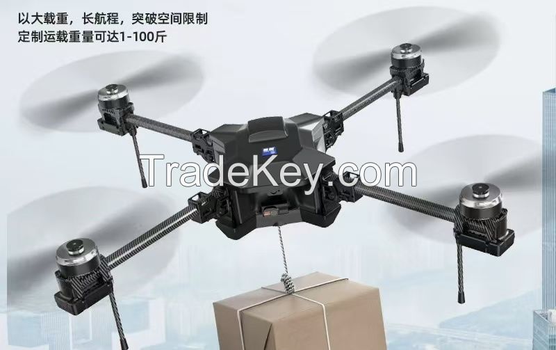
Surveying and mapping drones are drone systems specifically used for geographic information collection, topographic mapping, 3D modeling, etc., which quickly generate high-resolution maps, digital elevation models, and whole-photo images by carrying high-precision sensors and data processing softwareSurveying and mapping drones are drone systems specifically used for geographic information collection, topographic mapping, 3D modeling, etc., which quickly generate high-resolution maps, digital elevation models, and whole-photo images by carrying high-precision sensors and data processing softwareSurveying and mapping drones are drone systems specifically used for geographic information collection, topographic mapping, 3D modeling, etc., which quickly generate high-resolution maps, digital elevation models, and whole-photo images by carrying high-precision sensors and data processing softwareSurveying and mapping drones are drone systems specifically used for geographic information collection, topographic mapping, 3D modeling, etc., which quickly generate high-resolution maps, digital elevation models, and whole-photo images by carrying high-precision sensors and data processing software
| Country: | China |
| Model No: | max 66 character |
| FOB Price: | 500 ~ 1000 / Box ( Negotiable ) Get Latest Price |
| Place of Origin: | china |
| Price for Minimum Order: | 500 per Box |
| Minimum Order Quantity: | 300 Box |
| Packaging Detail: | pec |
| Delivery Time: | express delivery |
| Supplying Ability: | 20 Box per Week |
| Payment Type: | T/T |
| Product Group : | safety |


")


